
Short Pump Neighbors by Block
“Neighbor” can mean an adjacent tax parcel, a nearby address on the same street, a household in the same subdivision, or a person in the same precinct. Henrico records answer those questions in different ways. GIS shows parcel geometry and subdivision layers. Property Search gives published assessment context for a specific GPIN, PID, or address. The HOA map names a subdivision or association connection. The county organization directory supplies public association contacts. None of these sources is a complete list of occupants on a Short Pump block.
| Source | What It Shows About a Block | Access |
|---|---|---|
| Henrico GIS Real Estate MapServer | Tax parcels, condos, boundaries, subdivisions, lots, sections, and appraisal areas | Free viewer or REST Identify and Query; reference-only |
| Henrico Property Search | Published owner, assessment, physical, and sales context for a parcel | Free GPIN, PID, or address search; reference copy |
| Subdivision and plat records | Lot, block, phase, easement, subdivision, and legal relationships | Clerk record room, secure route, mail copies, or older microfilm |
| Henrico HOA lookup | Address-to-subdivision or association connection and a highlighted outline | Free map; covenants may be incomplete |
| County organization directory | Published association and civic contact information | 2023–24 directory, not an all-member list |
Ownership, mailing information, and occupancy are different facts. A trust, estate, lender, management company, or remote owner may receive a tax notice, while the parcel itself is the situs, or physical location. A map shows parcels that touch. It cannot show a current household. State the question and the source limit in every Short Pump neighbors research note.
Note: A Short Pump block result should name the map layer and custodian rather than label a parcel as a person's home.
Map a Short Pump Parcel Ring
Henrico's GIS viewer is the first map layer for the immediate block. It requires acceptance of a reference-only disclaimer, and its lines are not a survey or final legal boundary. The Real Estate MapServer offers Tax Parcels, Condos, Condo Boundaries, Condo Phases, Subdivisions, Subdivision Boundaries, Lots, Subdivision Sections, and Appraisal Areas. Its documented tools include Identify, Query, Find, QueryLegends, QueryDomains, Export Map, and return-updates operations. The service has a 2,000-record maximum or selection limit.
Search a known address or GPIN, select the target parcel, and compare its shape with the touching parcels. Record the layer name, map date, parcel ID, subdivision, and lot or phase clues. GIS is particularly useful when a street was extended, a parcel changed shape, a phase has a similar name, or an older legal description uses a road different from the mailing label. For an ownership question, return to Property Search or the Clerk after the parcel relation is understood.
Map limit. Henrico labels its GIS data as reference-only, so use a plat or recorded instrument when a legal boundary or easement question matters.
Following Adjacent Short Pump Parcels
The adjacent-parcel process stays focused on the target and the surrounding lots. It does not build a person-by-person block roster. A GPIN is Henrico's durable bridge from assessment and GIS into a deed or plat trail. Preserve the displayed facts and dates, then move from parcel geography to the proper custodian only when the record is relevant to the question.
- Normalize the target address with USPS and locate its Henrico GPIN or PID in Property Search.
- Use GIS Identify on the target and each touching parcel. Save the layer, retrieval date, parcel ID, subdivision, lot, phase, and a map image for the research log.
- Check whether a shared subdivision, condo boundary, or phase explains why two parcels appear adjacent.
- Search each relevant GPIN separately in Property Search, recording situs and mailing information only as displayed and without treating either as occupant proof.
- For a historical question, compare deeds and plats for the target and adjacent lot, then use printed directories or newspapers only when an address appears.
- For a public community contact, use the HOA map and organization directory instead of inferring association membership from a mailing address.
Henrico's online land-record digitization reaches back to 1947. The Clerk's record room, mail-copy procedure, and Library of Virginia microfilm cover the fallback chain when an instrument cannot be reached remotely. For a full named-street record sequence rather than a short parcel ring, use the Short Pump Street Directory.
Short Pump HOA Map Connections
Henrico's HOA lookup can connect an address to a subdivision or association and highlight the subdivision outline. It also hands off to an SCC entity route. The county cautions that covenants can be incomplete. Use the map to understand a subdivision relationship or find a public association contact, not to decide who belongs to the association or who lives at a particular address.
Henrico's HOA lookup map shows the address-to-subdivision route used for a Short Pump neighbors search.
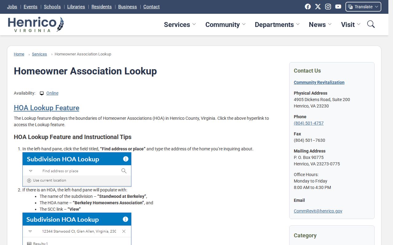
The highlighted-area view is a useful lead for a plat and public association contact, while the recorded documents and association itself remain the source for their own details.
Wyndham Forest's official association page says it covers Wyndham Forest, Chappell Ridge, Rivers Edge, Holloway, and Holloway Townes, has more than 665 homes, and formed in 1998. Sherbrooke's public site describes a 1987 community of 175 homes. Those published descriptions help place a subdivision in time, but they are not resident rolls.
Short Pump Public Association Contacts
Henrico's 2023–24 Directory of Organizations records public contact routes, not membership. Use these addresses and sites to reach an association about a public community matter or to understand the area connected to a subdivision name. A contact entry is a publication-time snapshot and should not be used to identify a household. Short Pump Ruritan and Short Pump Rotary are civic resources with public routes, but a club page cannot establish a member's address or status.
Wyndham Forest HOA
Official public association contact for Wyndham Forest, Chappell Ridge, Rivers Edge, Holloway, and Holloway Townes.
Sherbrooke
Official neighborhood contact route for the community described as formed in 1987.
Barrington HOA
Public directory address: 11424 Barrington Bridge Court, Richmond, VA 23233.
Bennington Ridge HOA
Public directory address: 12604 Cutler Ridge Drive, Richmond, VA 23233.
Other listed western-Henrico entries include Holly Glen Estates Neighborhood Association, Keswick HOA, Kingcrest, Kingston HOA, Lake Loreine HOA, Wynmoor Civic Association, and Wythe Trace HOA. Short Pump Ruritan describes a fourth-Tuesday monthly meeting and public contact route; Short Pump Rotary is another public civic contact. Confirm a present contact directly with the organization.
Note: Recheck a Short Pump association contact because the directory reflects a publication date, not a current membership roster.
Short Pump Block Permit Context
A permit, inspection, certificate, or code record can be an address-linked lead about the building, not a resident profile. Henrico's Build Henrico functions cover permits, inspections, certificates, and status. The system has a hard Legacy boundary for permits before August 30, 2021, so an older result may require a separate request path. Match a permit record to the parcel and its date, and do not turn an application name or mailing address into an occupancy conclusion.
Build Henrico is the county's entry point for these address-linked functions.
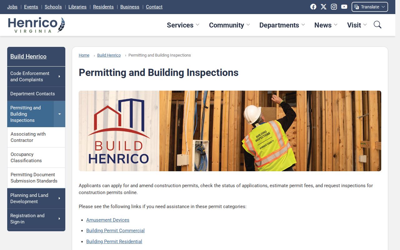
The capture shows the county portal category used to pursue building records. For older material, use the documented Legacy path or a county records request instead of assuming a current screen is complete.
Short Pump Neighbors and Precinct Geography
Election geography can describe a precinct, polling place, district, and postal address. It cannot provide a public all-occupant block roster. Henrico's polling-location table places the listed Short Pump-area precincts in the Three Chopt magisterial district, yet the postal labels vary. Short Pump at 4701 Pouncey Tract Road uses 23059, while Nuckols Farm and Pocahontas use 23233 and Innsbrook uses 23060. ZIP, precinct, subdivision, and community name are overlapping but different boundaries.
The Virginia Citizen Portal can answer a narrow registration-status or polling-place question through the appropriate individual workflow. Individual VERIS records are not a general FOIA roster. Voter lists have a separate statutory request route and Statement of Responsibility form under Va. Code §§24.2-404 through 24.2-407. Even an authorized election list is not proof that a registered person currently occupies an address. A person may have moved, be absent, or be protected.
Note: Short Pump precincts use county election geography, so confirm an address instead of relying on its postal label.
Short Pump Neighbor Source Comparison
Official records identify their custodian, scope, date, and access limit. Commercial neighbor-lookup tools are a separate category that may combine stale or mismatched information from unknown sources. For a parcel or association question, use the county map, property reference, recorded plat, or public organization route first. That leaves a clear way to verify a result or request a correction at the source.
| Source category | Useful question | Limit to keep in view |
|---|---|---|
| Official parcel and plat records | Which lots touch and how are they legally described? | Map lines are not a survey; a recorded instrument controls its own facts. |
| Official association and civic contacts | Which public organization is linked to a subdivision or community? | Contact information is not a member roster. |
| Election sources | Which polling geography applies to an address? | Not an occupancy list and subject to voter-file restrictions. |
| Commercial neighbor tools | May supply an unverified starting lead | Check currency, source, identity, and lawful use with the official custodian. |
For a correction, contact the county, state agency, Clerk, library, or organization that created the record. Removing a copied listing elsewhere does not alter a deed, parcel card, voter record, or association publication at its source.
Short Pump Neighbor Lookup Limits
Virginia public records are not a universal directory of Short Pump neighbors. Assessment fields, deeds, permits, court indexes, election records, business filings, professional licenses, and historical materials carry different meanings and may be outdated, redacted, or restricted. The Virginia Address Confidentiality Program gives eligible survivors a substitute mailing address, mail forwarding, and a three-year certification. Do not attempt to reverse a substitute or protected address with maps, deeds, voter records, or inference.
Sealed, expunged, juvenile, adoption, protective, and confidential-participant records need added care. Keep only the source identifier, date, and narrow fact needed for a property-history, civic, family-history, or record-correction question. Do not republish sensitive identifiers or protected addresses. When a parcel card, association listing, or court locator is wrong, ask its original custodian about the appropriate correction or confidentiality procedure.
Lawful personal use. Use a Short Pump neighbor lookup to understand a block, history, or public community contact. Do not use records to watch, stalk, harass, intimidate, or harm anyone.